


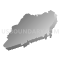
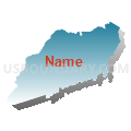
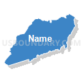
Henderson & Transylvania Counties PUMA, North Carolina
About
Outline

Summary
| Unique Area Identifier | 193646 |
| Name | Henderson & Transylvania Counties PUMA |
| State | North Carolina |
| Area (square miles) | 755.74 |
| Land Area (square miles) | 751.60 |
| Water Area (square miles) | 4.15 |
| % of Land Area | 99.45 |
| % of Water Area | 0.55 |
| Latitude of the Internal Point | 35.26742590 |
| Longtitude of the Internal Point | -82.64680210 |
Maps


Graphs
Select a template below for downloading or customizing gragh for Henderson & Transylvania Counties PUMA, North Carolina


Neighbors
Neighoring Public Use Microdata Area (by Name) Neighboring Public Use Microdata Area on the Map
- Buncombe County (Northwest) PUMA, NC
- Buncombe County (Southeast)--Asheville City PUMA, NC
- Greenville County (North)--Greer City (North & West) & Taylors (Central & East) PUMA, SC
- Haywood, Madison, Swain, Graham & Jackson (North) Counties PUMA, NC
- Jackson (South), Macon, Cherokee & Clay Counties PUMA, NC
- Pickens & Oconee Counties--Easley & Clemson Cities PUMA, SC
- Rutherford, Cleveland (West) & Polk Counties--Shelby City PUMA, NC
Top 10 Neighboring County (by Population) Neighboring County on the Map
- Greenville County, SC (451,225)
- Buncombe County, NC (238,318)
- Pickens County, SC (119,224)
- Henderson County, NC (106,740)
- Oconee County, SC (74,273)
- Rutherford County, NC (67,810)
- Haywood County, NC (59,036)
- Jackson County, NC (40,271)
- Transylvania County, NC (33,090)
- Polk County, NC (20,510)
Top 10 Neighboring County Subdivision (by Population) Neighboring County Subdivision on the Map
- Asheville city, Buncombe County, NC (83,393)
- Hendersonville township, Henderson County, NC (47,527)
- Upper Hominy township, Buncombe County, NC (16,789)
- Hoopers Creek township, Henderson County, NC (14,573)
- Limestone township, Buncombe County, NC (14,394)
- Mills River township, Henderson County, NC (13,470)
- Brevard township, Transylvania County, NC (11,623)
- Blue Ridge township, Henderson County, NC (11,172)
- Fairview township, Buncombe County, NC (11,111)
- Tigerville CCD, Greenville County, SC (8,186)
Top 10 Neighboring Place (by Population) Neighboring Place on the Map
- Asheville city, NC (83,393)
- Hendersonville city, NC (13,137)
- Brevard city, NC (7,609)
- Fletcher town, NC (7,187)
- Etowah CDP, NC (6,944)
- Mills River town, NC (6,802)
- East Flat Rock CDP, NC (4,995)
- Mountain Home CDP, NC (3,622)
- Dana CDP, NC (3,329)
- Flat Rock village, NC (3,114)
Top 10 Neighboring Unified School District (by Population) Neighboring Unified School District on the Map
- Greenville County School District, SC (466,178)
- Buncombe County Schools, NC (199,157)
- Pickens County School District, SC (119,224)
- Henderson County Schools, NC (106,740)
- Oconee County School District, SC (74,273)
- Rutherford County Schools, NC (67,810)
- Haywood County Schools, NC (59,036)
- Jackson County Schools, NC (36,627)
- Transylvania County Schools, NC (33,090)
- Polk County Schools, NC (20,510)
Top 10 Neighboring State Legislative District Lower Chamber (by Population) Neighboring State Legislative District Lower Chamber on the Map
- State House District 116, NC (85,268)
- State House District 117, NC (85,227)
- State House District 115, NC (79,480)
- State House District 112, NC (75,804)
- State House District 113, NC (75,113)
- State House District 119, NC (73,640)
- State House District 17, SC (37,353)
- State House District 1, SC (34,202)
- State House District 4, SC (33,418)
Top 10 Neighboring State Legislative District Upper Chamber (by Population) Neighboring State Legislative District Upper Chamber on the Map
- State Senate District 48, NC (193,127)
- State Senate District 50, NC (175,858)
- State Senate District 46, NC (165,888)
- State Senate District 5, SC (115,205)
- State Senate District 2, SC (97,675)
- State Senate District 1, SC (95,822)
Top 10 Neighboring 111th Congressional District (by Population) Neighboring 111th Congressional District on the Map
- Congressional District 4, SC (770,226)
- Congressional District 3, SC (722,675)
- Congressional District 11, NC (703,606)
- Congressional District 10, NC (689,468)
Top 10 Neighboring Census Tract (by Population) Neighboring Census Tract on the Map
- Census Tract 23.02, Buncombe County, NC (7,558)
- Census Tract 9603, Transylvania County, NC (7,519)
- Census Tract 9302, Henderson County, NC (6,797)
- Census Tract 22.05, Buncombe County, NC (6,412)
- Census Tract 9303, Henderson County, NC (6,408)
- Census Tract 302, Oconee County, SC (5,764)
- Census Tract 9605, Transylvania County, NC (5,710)
- Census Tract 9307.03, Henderson County, NC (5,578)
- Census Tract 9310, Henderson County, NC (5,532)
- Census Tract 9314, Henderson County, NC (5,476)
Top 10 Neighboring 5-Digit ZIP Code Tabulation Area (by Population) Neighboring 5-Digit ZIP Code Tabulation Area on the Map
- 28792, NC (32,689)
- 28715, NC (24,582)
- 29690, SC (20,914)
- 28739, NC (19,786)
- 28712, NC (19,347)
- 28704, NC (18,821)
- 28716, NC (17,477)
- 28732, NC (16,491)
- 28791, NC (14,171)
- 28711, NC (13,209)